
The Structure of a Modern Raster
The Structure of a Modern Raster The modern raster is a significant evolution from the old grids and images of the past. It differs in its geometric complexity and flexibility, its data storage flexibility, and its data compression options. A modern raster can support...How to use MRR Rasters in QGIS on Windows using GDAL
How to use MRR Rasters in QGIS on Windows using GDAL If you use MapInfo Pro and have the “Advanced” raster visualisation and processing plug-in, then you will be familiar with the MRR raster format. If you produce any rasters in MapInfo, either by gridding point data...Gridding LiDAR Bathymetry Data with MapInfo Pro Advanced
Gridding LiDAR Bathymetry Data using MapInfo Pro In this video, I take you through the exercise of downloading LiDAR point cloud data in LAS format, gridding the LAS files in MapInfo Pro Advanced, and then using ProRaster to render the rasters. I went looking for...
Spherical Cap Complete Bouguer Correction: Grid Examples
In this article I have some more examples of Spherical Cap Complete Bouguer Corrections. I compute theoretical corrections on a grid mesh for Tasmania and Hawaii and perform the correction for onshore gravity observations in Tasmania.
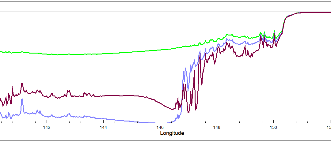
Spherical Cap Complete Bouguer Correction: Traverse Examples
In this article, I provide some examples of computations performed by my Spherical Cap Complete Bouguer Correction software including two traverses across the Australian continent.