
Gridding LiDAR Bathymetry Data with MapInfo Pro Advanced
Gridding LiDAR Bathymetry Data using MapInfo Pro In this video, I take you through the exercise of downloading LiDAR point cloud data in LAS format, gridding the LAS files in MapInfo Pro Advanced, and then using ProRaster to render the rasters. I went looking for...
Spherical Cap Complete Bouguer Correction: Grid Examples
In this article I have some more examples of Spherical Cap Complete Bouguer Corrections. I compute theoretical corrections on a grid mesh for Tasmania and Hawaii and perform the correction for onshore gravity observations in Tasmania.
Spherical Cap Complete Bouguer Correction: Traverse Examples
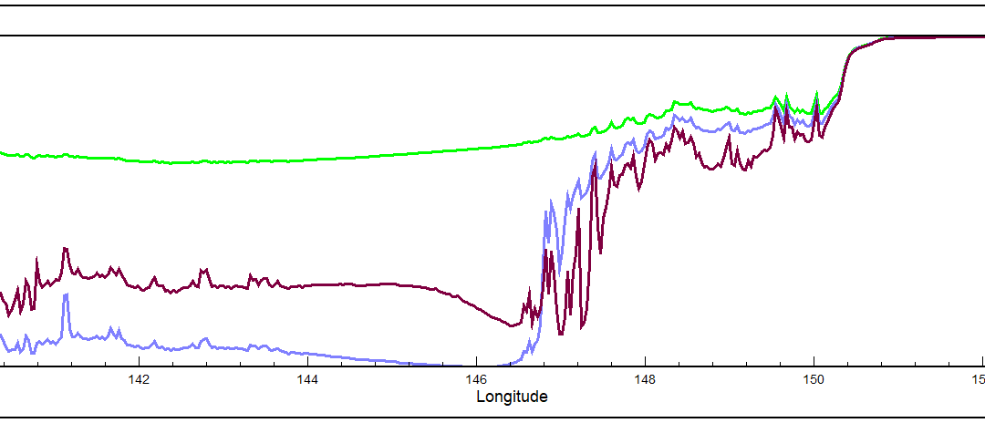
In this article, I provide some examples of computations performed by my Spherical Cap Complete Bouguer Correction software including two traverses across the Australian continent.
Spherical Cap Complete Bouguer Correction – Processing Methodology
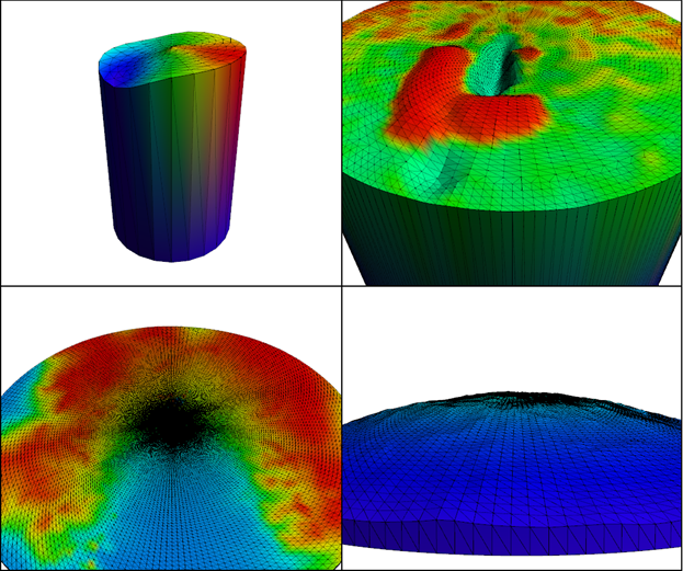
In this article I discuss the Spherical Cap Complete Bouguer Correction for gravity observations and my processing methodology for computing these corrections.